Deschutes River is BLOWN OUT! Full Flood Stage.
This will be my last fishing report of the year - we will be CLOSED from December 21-January 1 and will reopen on the 2nd of January.
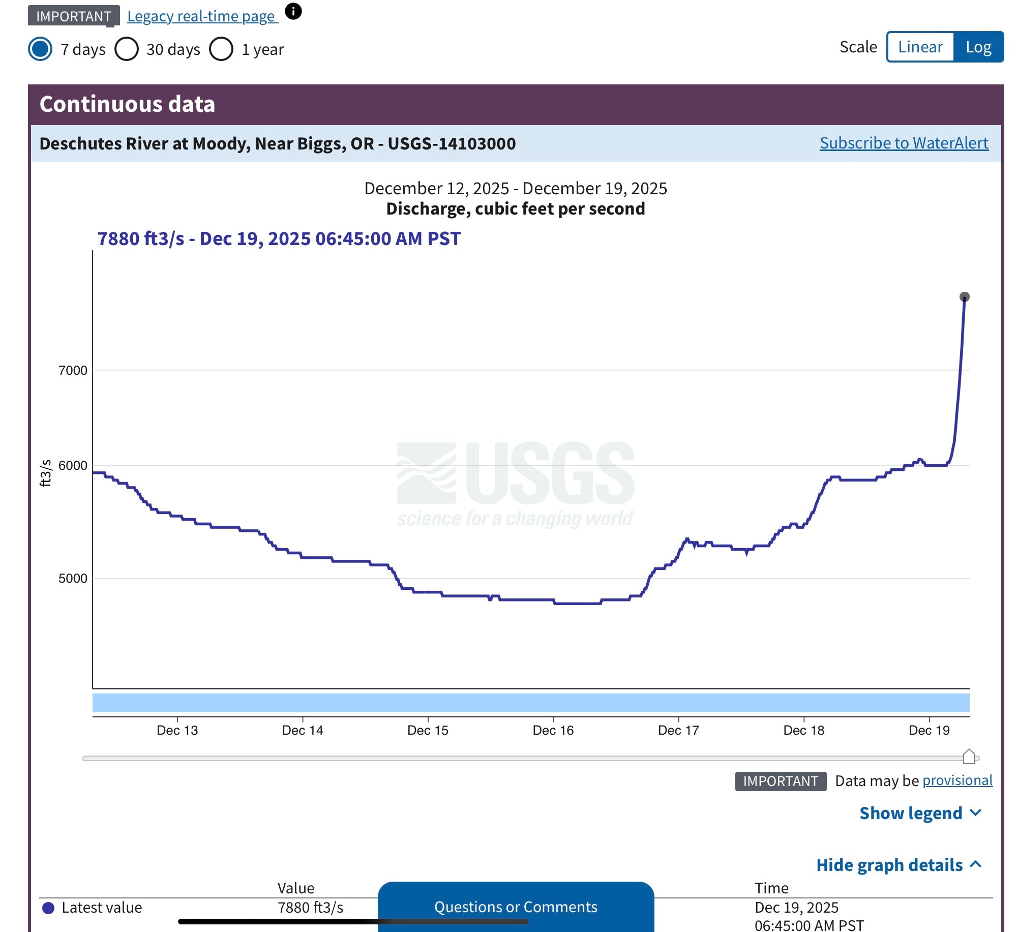
With all the rain as of late, I am not sure that there will be any fishable rivers or streams in Oregon or Washington. The Deschutes us huge and getting bigger by the minute. The graph above shows the USGS guage reading at Moody (down at the mouth of the Deschutes) and that line is going to continue to go straight up as the flood waters in the tributaries have not even begin to hit that part of the river.
Check out the guage at the White River in Tygh Valley:

The White River has twice as much water in it right now than the Deschutes had a few days ago. All of the tributaries of the Deschutes are in flood and the water coming out of the Madras dam is at 7400 CFS. Warm Springs river is close to 2000 CFS.
I started writing this early this morning and now I have been to a bunch of places on the river. It is way too high and brown to fish right now and it would be downright dangerous to float. There are many full trees coming down the Deschutes and the White River.
Here are some of the pictures I took today:

Wapinitia Campground - most of the sights are underwater.

The Wapinitia boat launch

Wapinitia Rapid - all rocks are submerged.

The river access road has lots of rocks on it.

High and Mighty - this is the area between the Moss Pool and Blue Hole

Sherars Falls is flat

The mist coming off of White River Falls

White River at 8000 CFS (normal flow is 300 CFS)


Good grief—I hope it didn’t wipe out as much tree cover as in ‘96.