Finally, a cool down.
HOLIDAY CLOSURE: JULY 4 - HAVE A HAPPY FOURTH!!!!!
IMPORTANT ANNOUNCEMENT - TROUT CREEK CAMPGROUND AND BOAT LAUNCH/TAKEOUT MAY BE CLOSED (read on for the latest info)
Things have started to cool down a bit out here on the Deschutes River - at least the air temperatures are dipping into double digits instead of triple digits. The thermostat out here hit 117 on Monday and Tuesday, which was beyond miserable. This was not good for the health of the Deschutes as water temperatures soared and we saw and are continuing to see 20-22 degree temperature differentiations between the dam and 100 miles downstream at the mouth. Afternoon temperatures at the mouth of the Deschutes (Moody temperature gauge) neared 75 degrees - which is possibly the highest water temperature ever taken at Moody in the history of mankind. Temperatures this high are extremely dangerous to coldwater fish (trout, salmon, steelhead) and certainly lethal to any salmonid hooked and played in these temperatures.
Due to these high temperatures, ODFW implemented Hoot Owl measures on July 1 which are set to continue through the end of September. The Hoot Owl measures apply to the section of the Deschutes from Sherar's Falls downstream to the confluence with the Columbia River. Currently, the Hoot Owl does not apply to the section of the Deschutes upstream of Sherar's Falls (roughly the 50 miles from the dam down through and 8 miles past the town of Maupin). ODFW may choose to change the parameters of the Hoot Owl closure if water temperatures continue to warm throughout the river corridor.
What does this mean for your fishing? Well, the caddis hatches came alive when the dam operators were forced to lower the water temperatures coming out of the Madras dam complex. We saw blizzards of caddis like we have not seen since PGE warmed the waters of the Deschutes. The trout were happier and feeding on top, but the area of the river that benefitted from that cold water was upstream of Maupin. The river down to Mack's Canyon and below continued to suffer due to super warm water.
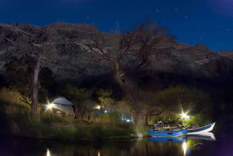
We have been sticking above Sherar's Falls for the most part and have been hooking trout on everything from caddis patterns, to purple chubbys, to Euro nymphs. It was too hot for most people to tromp around on the bank, so the few anglers who were out here pretty much had the river to themselves.
Fourth of July weekend is never as busy as one might think out here on the Deschutes. For one, fireworks are absolutely 100% banned and always have been. This year, the enforcement is going to be extreme due to the tinderbox that was created with the ultra-high temperatures of this week. There will be a straight-up $750 fine for using any kind of firework - even legal harmless fireworks like sparklers. If you start a wildfire with your fireworks, you will be held criminally responsible. So, please leave the fireworks at home - we are already dealing with several wildfires in the area.
Even though Maupin has wildfires to the north and south - our skies are clear and sunny and there is only the tiniest sniff of smoke in the air. The wildfires are not impacting life on the river down here, but they might impact your plans if you are going to float Warm Springs to Trout Creek (read on for the official BLM announcement).
Let's talk wildfires. The 10,000 acre fire called the Wrentham Market Fire was threatening to crawl down into the Deschutes Canyon, but it appears that they are able to keep it up on top of Tygh Ridge for now. Here is a photo of that fire in action:

A new fire started last night just outside of The Dalles and closed highway 197 for a few hours as the fire gre to just under 1000 acres. They are getting a handle on that one today and the highway which connects Maupin to The Dalles is open once again.
Further upriver, a 100 acre fire that started on the Warm Springs Reservation near the mouth of the Warm Springs River jumped the Deschutes and appears to have completely burnt up the South Junction BLM campground. The South Junction road is closed. That fire is called the Rattlesnake Fire and it is over 5000 acres burning north and east towards Trout Creek Campground. Trout Creek Campground is currently under a level 2 evacuation notice and the BLM is advising people to stay out of the campground and to not launch or take out at the boat ramp at Trout Creek.
In this picture, you can see the Deschutes River flowing toward us with Green Valley Farm (located at the end of the South Junction road) jutting out into the river and the fire blowing away from it. Thank goodness Green Valley was spared, but the South Junction campground (just downstream) appears to be toasted. The Half circle of green that you see in the bottom of the picture is on the reservation side of the river:

Here is the official email from the BLM:
Dear Partners, Friends, and Other Interested Parties of the Lower Deschutes Wild & Scenic River
Please see the following updates regarding wildland fires on or near the Lower Deschutes Wild & Scenic River:
Wrentham Market Fire: Reported on June 29 at 1:30 p.m. on unprotected lands in the Columbia Rural Fire Protection District. The fire was mostly burning through wheat and brush and moving towards the Deschutes River. Resources from the Bureau of Land Management/Central Oregon Fire Management Service went into unified command with the Oregon State Fire Marshals this morning to support operations. The Level 3 evacuation notices issued by the Wasco County Sheriff’s Office for homes in the area threatened by the fire. Currently fire progression has been stopped and it is no longer moving toward the river. Size is estimated around 10,000 acres..
Rattlesnake Fire: Reported on June 30th in the afternoon, the fire burned approximately 100 acres on the Warm Springs Reservation in grass, brush and juniper before jumping the Deschutes River. it is now estimated at over 4500 acres. The fire is now under the unified command of Warm Springs Incident Commander Lionel Smith and Type 3 Central Oregon Fire Management Service (COFMS) Incident Commander Larae Guillory. Four large air tankers, two Single Engine Air Tankers (SEATs), a heavy helicopter, are responding to the blaze in addition to the Central Oregon Rappellers and Redmond Hotshots.
The fire is currently moving to the east and south, threatening the Trout Creek Boat Ramp and Campground. Trout Creek Campground and boat ramp are under a level 2 evacuation. We are advising boaters to not use the Trout Creek boat ramp as a put-in or take-out at this time. Trip leaders holding boater passes using the Trout Creek boat ramp July 2, 2021 are advised to choose an alternate site/ramp or request that their pass be canceled (no refunds are authorized at this time). Trip leaders can change a launch or take-out in the same segment through rec.gov if the boater pass has not yet been printed. If a change is needed in a different segment, if your pass has already been printed and you would like to cancel it, or if you have any further questions, please contact the Prineville BLM at (541) 416-6700.
In addition the fire burned through the South Junction Campground, which is under an emergency closure until further notice so BLM personnel can assess any possible hazard to the public as well as the conditions of all facilities.
Now, let's get back to a discussion on water temperatures in the Deschutes River.
PGE saw the water temperatures soaring over the past few weeks and yet they continued to release warm water off the surface of the reservoir until the evening of June 21 when they flipped a switch (a switch in their SWW selective water withdrawal tower) and water temps on the Madras started dropping from the high temperature of 59.5 degrees over the course of one week to a low of 53.5 degrees on June 29. This immediately translated into water temperatures dropping at the mouth (Moody gauge) but only for a couple of days and then the blast furnace temperatures hit. As the SWW mixed water from the bottom of the reservoir in order to cool the releases at the dam, the 110-117 degree air temperatures and the low flows (sub-4000 cfs) of the Deschutes negated the impact of that cooler water and temperatures once again began to rise on the Moody Gauge. On the night of June 29 the temperatures at the Moody Gauge surpassed 74 degrees yet this was the day that PGE released water from the dam at the lowest temperature thus far in June 53.5 degrees.
Before we give PGE kudos for their actions, let's not forget that their failure to lower water temperatures in the past did result in two major fish kill incidents in the lower Deschutes in 2015, and they are desperately trying to paint their fish reintroduction program in a positive light. Their reintroduction of salmon and steelhead above the reservoir is failing miserably, has been for ten years, yet they keep pushing forward telling the public that they just need a little more time.
Let's also not forget that PGE engineered the SWW in such a way that the maximum amount of bottom water (bottom of the reservoir - cold, clean, perfect water) that they say they can now release is only 60% bottom water. This means that AT MINIMUM 40% of the water that is being released into the Deschutes is the slimy, algae-laden, low dissolved oxygen, hot water off the top of the reservoir. A lot of the time, this poor quality water makes up 100% of what PGE releases into the Deschutes. This consistently violates the Clean Water Act and endangers the trout, steelhead, and salmon on the Deschutes River.
This week the demand for power was huge - with all air conditioning units running at full blast throughout Central Oregon. PGE had to generate power at maximum capacity, and (apparently) releasing the coldest possible water from the dam while simultaneously producing maximum power are not mutually exclusive actions for them to take. Interesting!
Let's hope that the Deschutes River trout, steelhead, and salmon are able to survive the hot temperatures in the lower reaches. We should all be fighting for the managers of the dam to do everything in their power to keep the river as cool as possible. They will, no doubt, blame global warming, but the reality is that the river could be kept much much cooler by increasing the bottom releases. If PGE can point to something like global warming - which is most certainly rearing its ugly head this summer with record-breaking heat - as a problem, and PGE HAS an option to do something to help out (like releasing as much cold water as the reservoir can give) why does PGE choose to continue on its path of ten years of warming the Deschutes? Turn off the hot water tap and let her run cold, please, PGE.


Thanks for your post. MJ, I think we need to be aware of global warming (which is clearly at play) AND PGE’s actions (which seem to be contributing to the problem). Vern, I hear you on wanting a " fishing reliever," but if we do not I advocate for healthy rivers, at some point there will be no fishing.
Came here for the fishing reliever and all I see is a rant about, heat, wildfires and the power company
I have to guess it’s more money to release colder low lying levels?
Why does PGE insist on ruining the river temps?
Hey MJ, did you even read the latter part of this post? Ignoramus
“They will blame global warming…”. Is PGE responsible for 117 degrees farenheit?